 Mount Rogers is most famous for being the highest point in Virginia with a height of 5,729 feet (1,746 m) above sea level!
There are a few different trail options you can take leading to the summit. This includes the Elk Garden Trailhead which approaches Mount Rogers from the west and is a 9 mile round trip hike. The Mount Rogers Trail approaches the summit from the north and is 12 miles round trip. The most popular hiking route to the summit is from the south approach located in Grayson Highlands State Park via Massie Gap. Not only is this trail the shortest, but also the most scenic out of the three. This trail is an 8 mile round trip hike and I decided to hike up and camp out for the night.
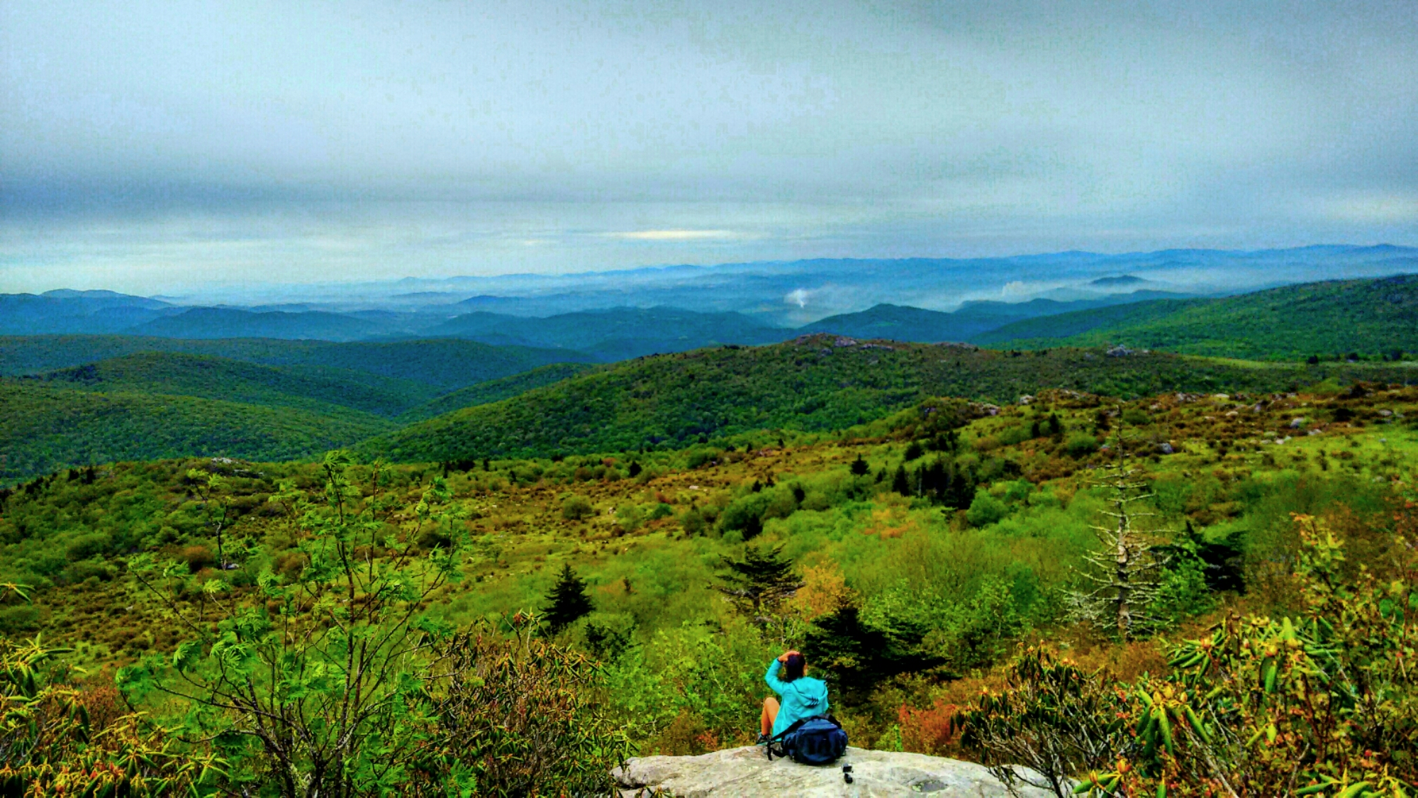
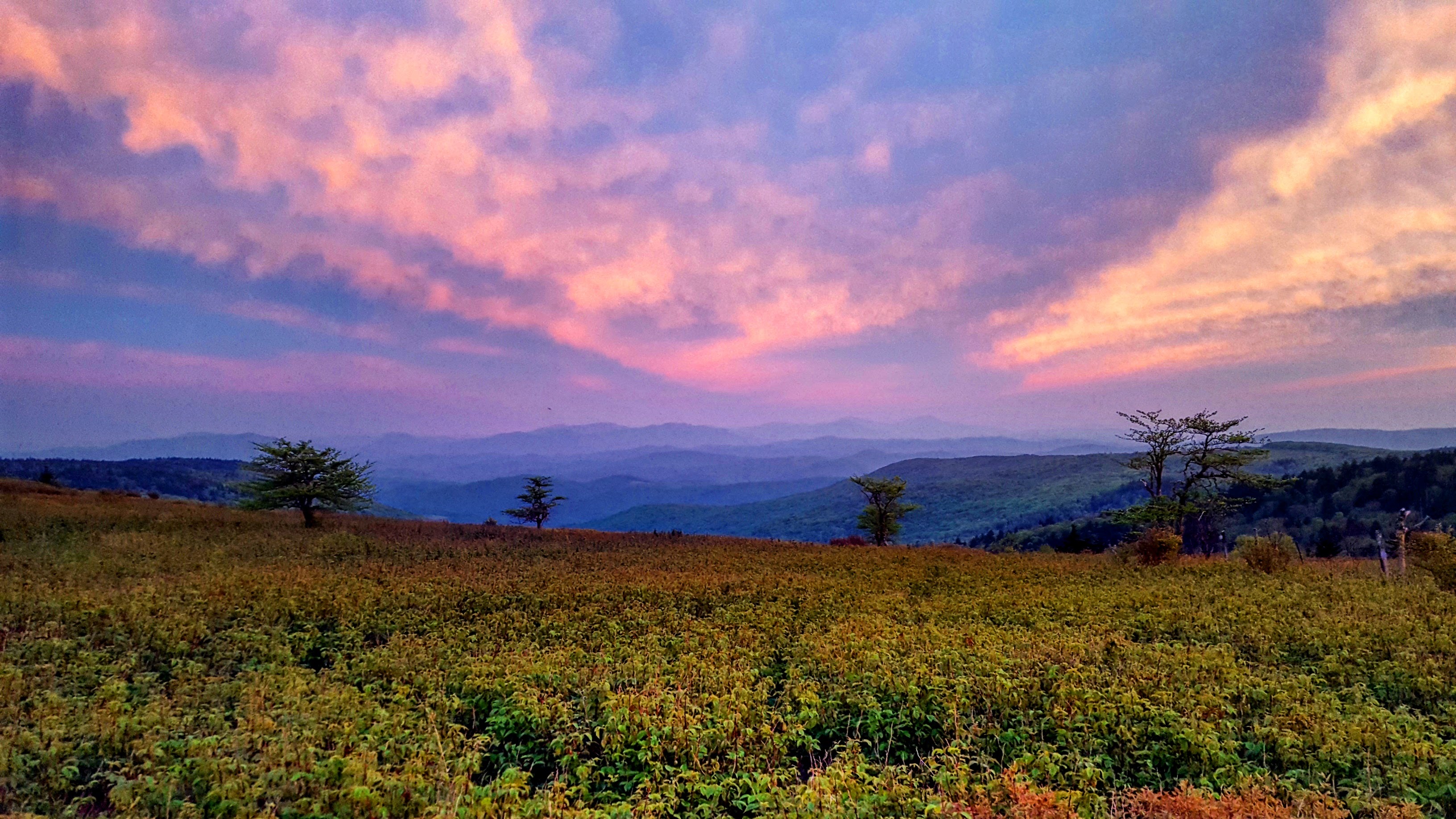
The trails approaching the summit provide the most scenic, sweeping views of the Blue Ridge Mountains. On your trek up, you will pass open grassy meadows and even wild ponies! This was something I had not experienced before and I could not believe that this was in Virginia!
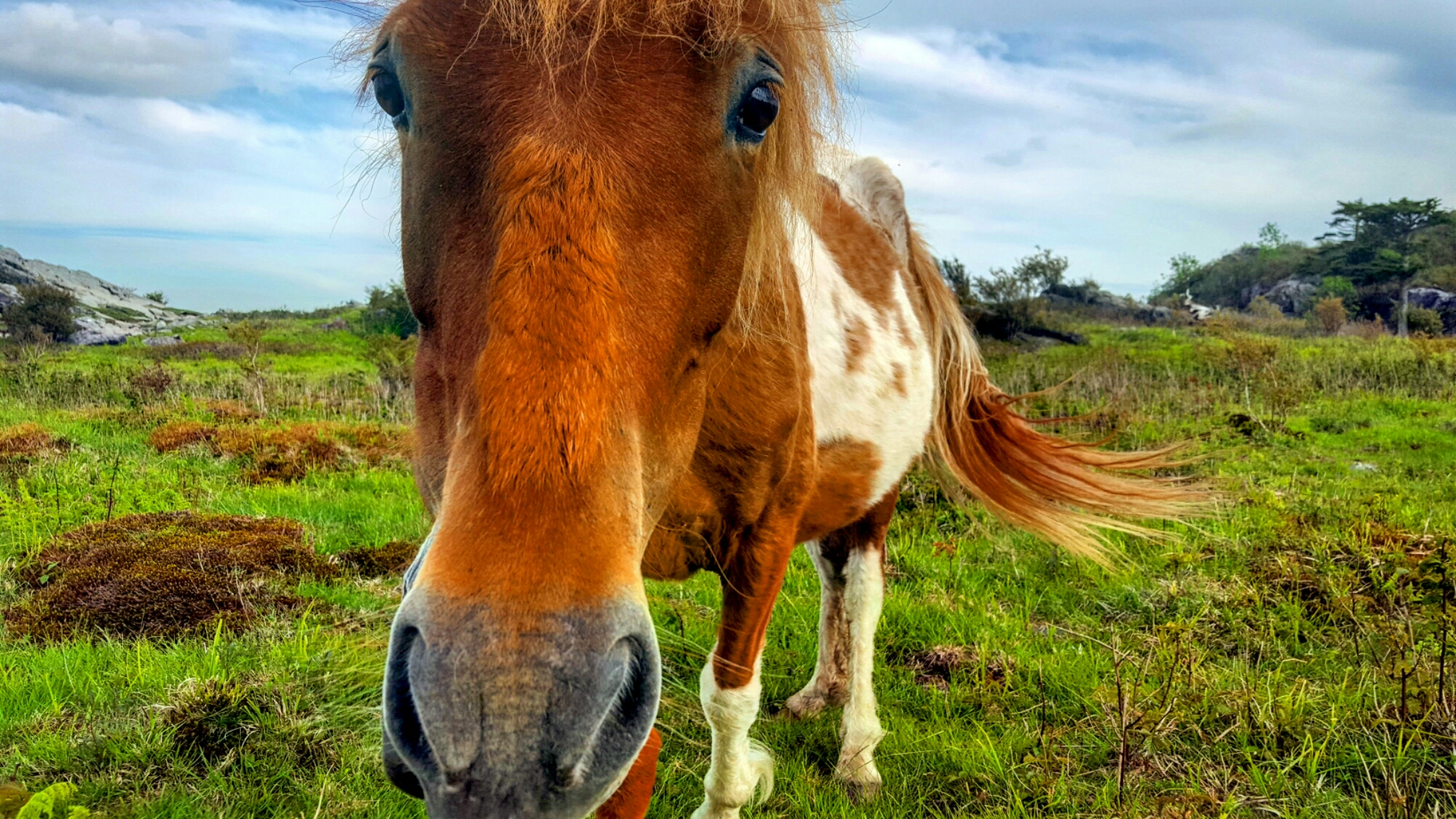
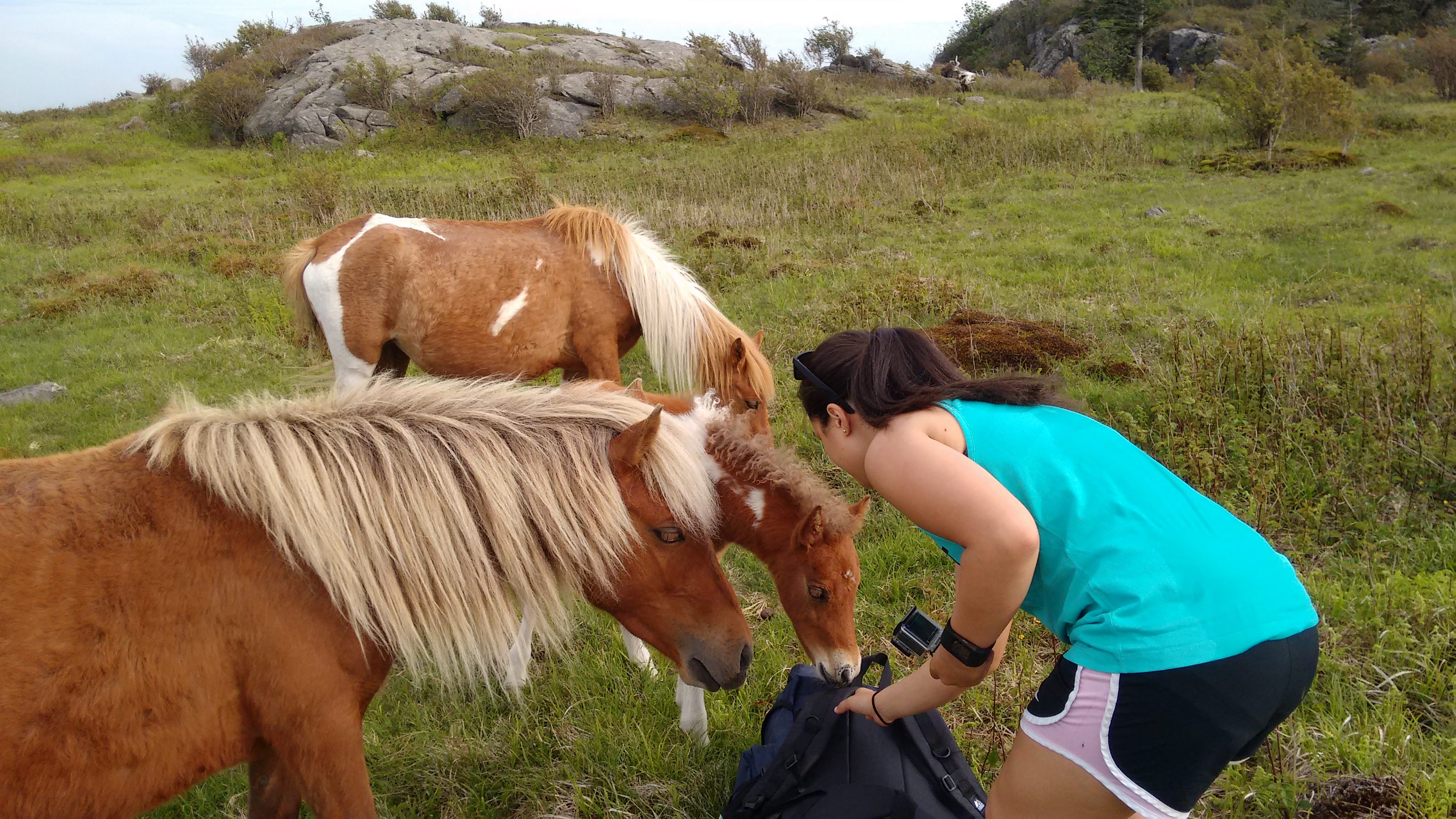
Although these ponies may be considered wild, they have learned to become very comfortable with people who pass through the park.
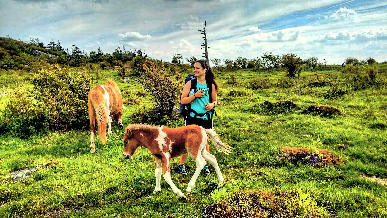
I even had the pleasure of petting a few ponies that came up to me!
Be warned though, these wild ponies are extremely spoiled and were begging me for food.
Not only did I see wild ponies, but there were even some bulls hanging out in the meadow! I did not dare get any closer though!

There were many campsites located along the trail on the way up. It was a popular weekend for camping and most of the camp sites seemed to be taken. I kept continuing along the path and thankfully lucked out with one of the most scenic and last campsites before the top. I was able to get the tent set up just before sun down and the views did not disappoint!
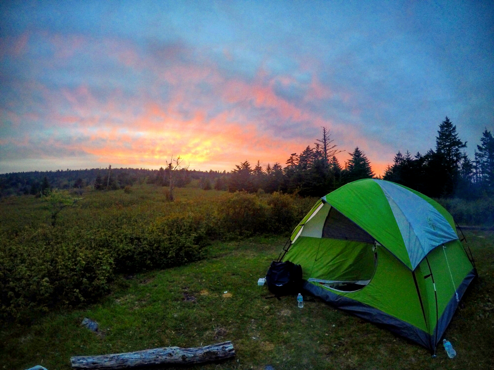 I was spoiled to a breathtaking mountain sunset as the sky lit up in various shades of pink!
 I even made myself my own fire and spoiled myself to some smores! Who wouldn’t want to wake up to this!?
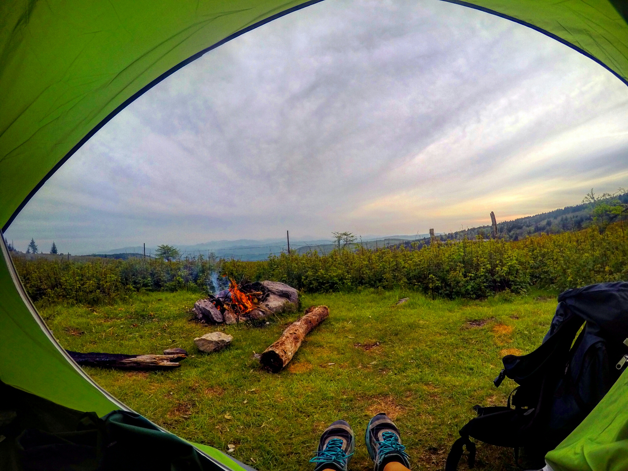 The next morning I arose to the sound of drizzling rain. The rain had thankfully died off by the time I decided to pack up which made for a cool morning hike. It was only a few short miles left to the top.
The top of Mount Rogers features the most northern high-altitude Southern Appalachian spruce-fir forests. The only one of its kind in the state of Virginia with only 5 others in existence! This forest, in particular, is one of the few remaining that contain a Fraser fir tree; a high altitude evergreen tree normally found above 5500 feet (1700 m) in elevation.
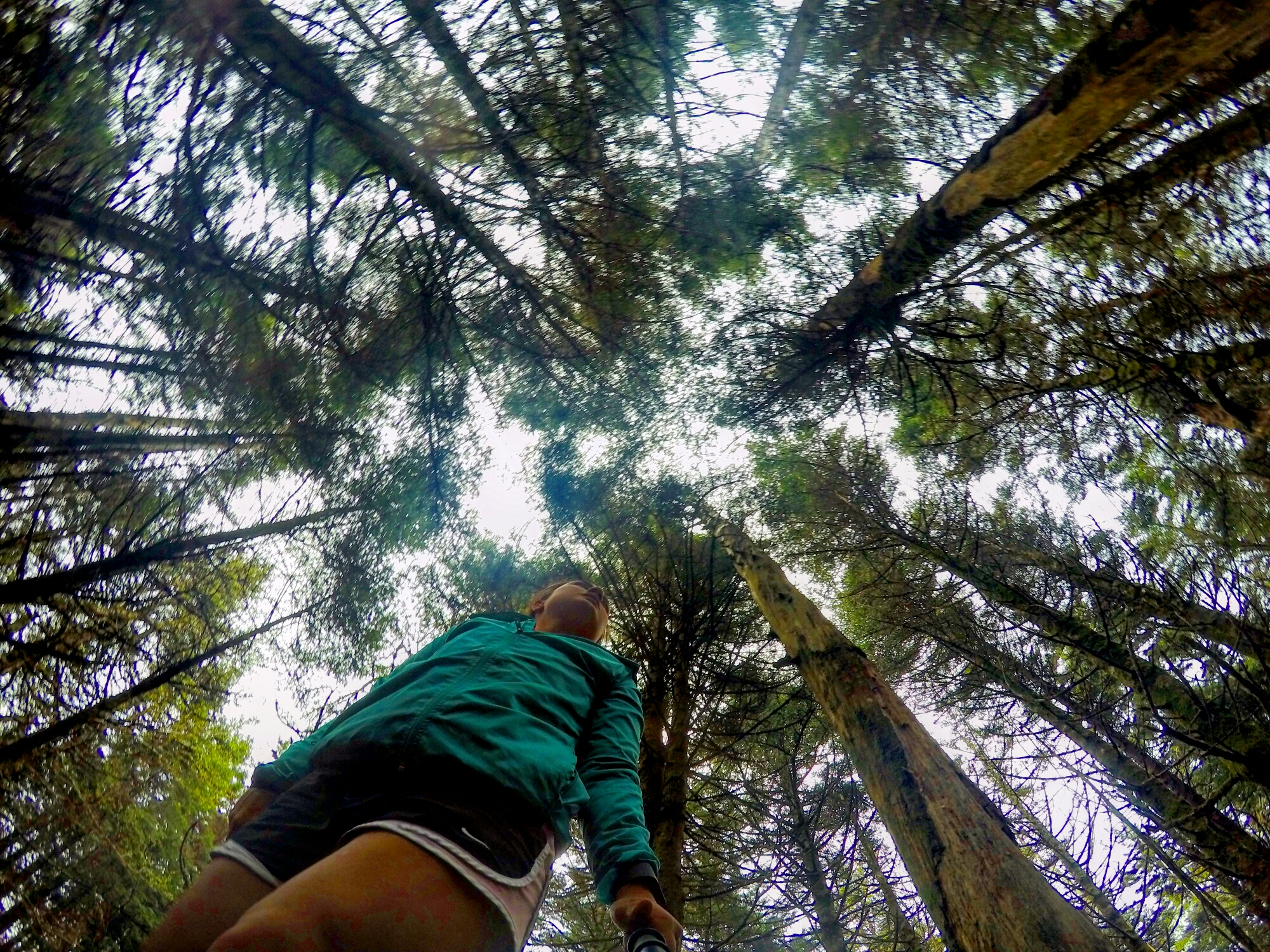 I had never seen trees like this before and I felt like I was in another world when I entered the spruce-fir forest. It was quite a magical experience and I was still in shock that this was located right here in my home state of Virginia!
Contrary to most hikes, the top of Mount Rogers does not feature an overlook because of the dense spruce-fir forest. Nonetheless, the hike up approaching the summit more than made up for the scenic vistas. When you approach the top, there is a National Geodetic Survey triangulation station disk on the rocks in the middle of the forest. They are easily missed and not the most impressive.
Overall Mount Rogers was one of the most amazing hikes I have ever done in the state of Virginia. The wild ponies, open grassy meadows, the scenic sweeping views of the Blue Ridge Mountains, and the magical Southern Appalachians spruce fir forest definitely make it one of my favorite hikes around. Despite it’s far distance, Mount Rogers is worth the drive if you’re looking for a scenic hike. Plus it is the highest point in Virginia that even features wild ponies!
DRIVING DIRECTIONS
Grayson Highlands State Park is located near the border of North Carolina and Tennessee. From where I live in Fairfax, Grayson Highlands State Park was 342 miles away and about a 5 hour and 16 minute drive. When you enter the park, the park rangers will direct you to where you need to park at the beginning of the trail head. It was very crowded that weekend and the parking spots were full so many cars parked over on the side of the road.
- From Interstate 81 S take exit 50 toward VA 11/Atkins
- Take Va-16 S for 47 miles to VA0362 N in Wilson Creek
- Turn left onto Nicks Creek Rd for 4.4 miles
- Turn left onto VA 16 S for another 17.4 miles
- Turn right onto US-58 W for 7.7 miles
- Then turn right on VA 362 N for 1.8 miles to enter Grayson Highlands State Park
TRAIL DIRECTIONS
To reach the summit via the popular Massie Gap look for a huge open field. You will follow the signs and start out on the Rhododendron Trail for about half mile towards the Appalachian Trail. You will then turn left and follow the Appalachian Trail up towards Wilburn Ridge through the Rhododendron Gap. As you continue you will pass the Thomas Knob Shelter to the short spur trail which leads to the grand finale at Mount Rogers summit!
FEES
There is a fee when entering Grayson Highlands State Park. For weekends there is a $3 fee and during the week there is a $2 fee.

Leave a comment